
Cruise passengers leave the Galataport terminal through the D Block lobby on to the waterfront. From there, the T1 tram stops at Tophane and Fındıklı are the official public transport links, the Karaköy ferry pier is about 8 minutes on foot, and Sultanahmet is five tram stops beyond Tophane. There is no metro station inside Galataport.
Last checked: 4 November 2026. The tram, ferry and terminal facts come from Galataport’s official pages (in Turkish) and Metro Istanbul. Walking times are our own calculation from OpenStreetMap data.
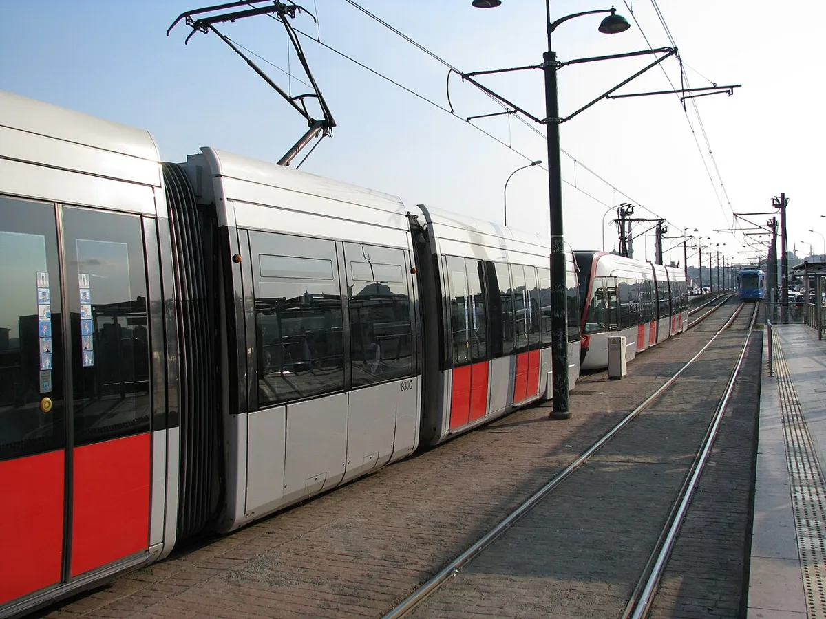
Leaving the Galataport cruise terminal
- Ship to terminal: passport control and customs are in the underground terminal, according to the official cruise port page. Keep your passport and ship card with you.
- Terminal to waterfront: Galataport tells tour guides to meet guests at the D Block terminal lobby, opposite the Axa Sigorta building and next to the Mimar Sinan University museum. This is the pedestrian exit.
- Meeting points outside: in front of the museum in K Block, the Museum Square by the Clock Tower, the Rıhtım Square by M Block, and in front of the Paket Postanesi. Use them as landmarks if you arrange to meet someone.
However, Galataport does not publish a map of pedestrian gates or photographs of the exit signs. The exit you take depends on where your ship is berthed, and the corridor below ground can be long. So follow the signs for the city and the terminal lobby, and ask the staff if you are unsure.
Your options at a glance
| Option | Time (our estimate) | Best for |
|---|---|---|
| T1 tram from Tophane or Fındıklı | 5 stops from Tophane to Sultanahmet; allow 10 minutes to reach the stop | Sultanahmet, Eminönü and the Grand Bazaar area |
| Walk to Galata Bridge | About 13 minutes (0.98 km) | Eminönü, Spice Bazaar, Galata views |
| Walk to Galata Tower | About 12 minutes (0.89 km), uphill at the end | Beyoğlu and the Galata side |
| Yellow taxi | Fare depends on the route and traffic | Mobility needs, bad weather, little time |
| Ferry from Karaköy or Kabataş | Varies by route | Bosphorus views and the Asian side |
The T1 tram
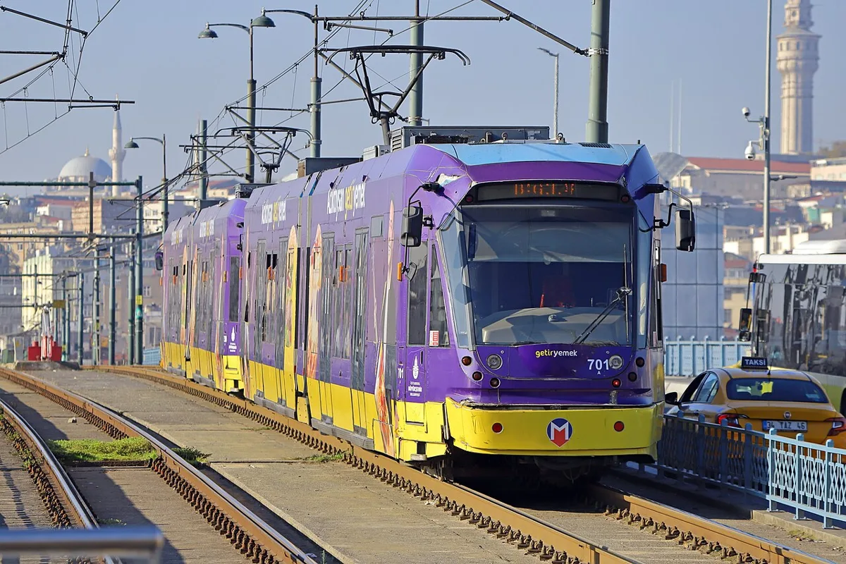
The Metro Istanbul’s T1 line page lists the stops in this order: Kabataş, Fındıklı-Mimar Sinan Ü., Tophane, Karaköy, Eminönü, Sirkeci, Gülhane, Sultanahmet, Çemberlitaş and Beyazıt-Kapalıçarşı. It runs from 06:00 to 00:00, about every 2 minutes at peak times, and a full one-way trip takes 65 minutes.
Galataport’s official transport page names Tophane and Fındıklı as the stops to use. It gives no walking time, so allow about 10 minutes and look at the map. At Karaköy the tram connects with the F2 Tünel funicular to Beyoğlu, and at Kabataş with the F1 funicular to Taksim, where the M2 metro runs.
Fares and cards
Fares change, and we could not confirm which number on the Metro Istanbul fare page is the single-ride price, so we do not quote one. Our Istanbulkart guide explains how to buy and top up an Istanbulkart. Also, we could not confirm that contactless bank cards work at the tram gates, so carry a card or a ticket. In addition, do not let a stranger at a ticket machine touch your money or your card. See our guide to common tourist scams.
Walking
These times are calculated from OpenStreetMap walking routes starting at the middle of the Galataport complex. They assume about 4.5 km/h on flat ground, so hills and crowds will make real times longer.
| Destination | Distance | Walking time |
|---|---|---|
| Karaköy ferry pier | 0.56 km | 8 min |
| Nusretiye Mosque | 0.63 km | 8 min |
| Galata Tower | 0.89 km | 12 min |
| Galata Bridge | 0.98 km | 13 min |
| Spice Bazaar (via the bridge) | 1.65 km | 22 min |
| Hagia Sophia | 2.64 km | 35 min |
| Blue Mosque | 2.87 km | 38 min |
Sultanahmet is a long walk if you have only a few hours, which is why we suggest the tram for the outward journey.
Taxi
The official Istanbul tariff for a standard yellow taxi is 71.94 TL to start, plus 47.92 TL per kilometre, with a minimum fare of 230 TL, in force since 20 July 2026. By our calculation, a trip of 3 to 5 km costs about 230 to 312 TL on the meter before traffic and tolls. Sultanahmet is roughly 3 km away on foot, and the road route may be longer. See our Istanbul taxi fares guide for how the meter works and what to check.
Ferries and the Deniz Dolmuş
Galataport says you can reach it from the Karaköy and Kabataş ferry piers. It also runs a Deniz Dolmuş sea shuttle from the Kadıköy–Üsküdar and Bebek–Ortaköy piers, on weekdays only, at 250 TL. Payment is by bank or credit card at the pier kiosk; cash, Istanbulkart and the Mavi Dijital Kart are not accepted. For the city ferries see our ferry disruption guide and Bosphorus cruise guide.
Getting back to the ship
Check the all-aboard time on your ship’s daily programme, because it is set by the cruise line and changes by port. We suggest planning to be back at the Galataport cruise terminal at least an hour earlier, since passport and security checks happen in the terminal. Also, allow extra time for the T1 at rush hour, when it is one of the busiest tourist lines in the city. Our guide to getting around Istanbul has more on the tram.
What we could not confirm
- The official pages do not name pedestrian gates or give walking times to the tram stops.
- We could not find a metro station at Galataport; the closest metro link we could verify is the F1 funicular from Kabataş to Taksim and the M2.
- The all-aboard rules and any shuttle service depend on your cruise line.
Where to go next
Read our Galataport guide for what is inside the complex.
